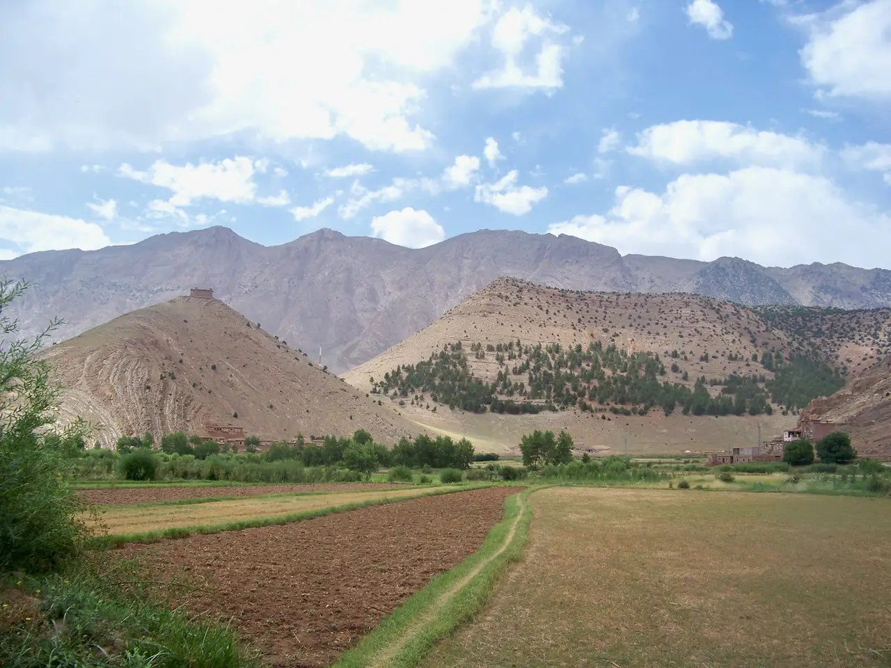
VillageCoordinates: 31.66° N, 6.44° W
Aït Bouguemez
أيت بوكمازⴰⵢⵜ ⴱⵓⴳⵎⵎⴰⵣ
Valley emerald and walnut orchard earth
See on the map
At a glance
- Recommended stay
- 3 to 5 days
- Best season
- April to June (blooming apple and walnut blossoms) and September to October (crisp harvest weather)
- Elevation
- 1,800 m
- Best for
- Independent backpacker hut-to-hut village trekking staying in traditional family gîtes · Climbing the conical hill of Agadir Sidi Moussa for 360-degree views over the green valley floor · Discovering prehistoric dinosaur footprints embedded in Jurassic limestone slabs at Ibaqalliwn · Acclimatization base for ascending Mount M'Goun (4,068m) and traversing the dramatic M'Goun Gorges
- Key landmarks
- Agadir Sidi Moussa (conical pyramid granary and marabout sanctuary)Ibaqalliwn Jurassic dinosaur footprintsTabant weekly Sunday mountain marketArous gorge and traditional earthen architectureTrailheads for Mount M'Goun (4,068 m, Morocco's second-highest summit)
The Happy Valley of the High Atlas: hut-to-hut backpacker trekking, dinosaur tracks, and conical hill granaries.
Getting there
Grand taxi from Marrakech to Azilal (3 hours), then shared transit van into Agouti/Tabant (2 hours)
The Happy Valley: Morocco’s Backpacker Haven
Enclosed by the snow-crested limestone walls of the Central High Atlas beneath Mount M’Goun (4,068m), the Vallée des Aït Bouguemez—often called the “Happy Valley”—is Morocco’s premier destination for independent hikers and backpackers. Spanning thirty kilometers of fertile riverbed lined with apple and walnut orchards, the valley floor connects dozens of traditional earthen Amazigh hamlets where local hospitality remains untouched by commercial mass tourism. Independent travelers hike village to village along ancient stone paths, resting each evening in welcoming family-run gîtes d’étape over home-cooked tagines and mountain mint tea.
Dinosaur Tracks and Sacred Granaries
The valley holds extraordinary cultural and geological treasures. At Ibaqalliwn, gigantic three-toed dinosaur footprints from the Jurassic period are embedded directly into smooth rock slabs beside the trail. Dominating the center of the valley near Timit rises the distinctive conical pyramid hill crowned by Agadir Sidi Moussa, an ancient fortified circular granary offering panoramic views across the emerald patchwork of terraced fields. As the premier gateway for traversing the M’Goun Massif and descending through the famous water-filled M’Goun Gorges, Aït Bouguemez is an unmissable mountain paradise.
Weather and climate
Weather now
Live–––
- Feels like
- ––
- Wind
- –
- Humidity
- –
- UV index
- –
- Today's UV peak
- –
Next 12 hours
Climate by month
Average low and highRainy days
| Month | Average low and high | Rainy days | Event |
|---|---|---|---|
| Jan | -5°C – 10°C23°F – 50°F | 5 | — |
| Feb | -5°C – 9°C22°F – 47°F | 11 | — |
| Mar | -1°C – 18°C31°F – 64°F | 3 | — |
| Apr | 3°C – 20°C37°F – 69°F | 13 | — |
| May | 5°C – 19°C40°F – 66°F | 10 | — |
| Jun | 10°C – 24°C49°F – 75°F | 8 | — |
| Jul | 14°C – 32°C57°F – 89°F | 0 | — |
| Aug | 13°C – 31°C55°F – 88°F | 4 | — |
| Sep | 8°C – 26°C47°F – 78°F | 2 | — |
| Oct | 6°C – 22°C42°F – 71°F | 2 | — |
| Nov | 1°C – 19°C33°F – 66°F | 2 | — |
| Dec | -1°C – 16°C30°F – 60°F | 2 | — |
Source: Open-Meteo Reanalysis at 31.661N 6.444W. Updated November 7, 2026. open-meteo.com
Suggested itinerary
Checked by Morocco Insider Tips on November 9, 2026
Day 1 Day 1 — Agouti Arrival, Walnut Groves & Sidi Moussa Granary
- Morning
- Arrive at Agouti at the gateway to the valley. Walk along the willow-lined irrigation channels (*seguia*) through lush apple and walnut orchards between mud-brick Amazigh villages.
- Afternoon
- Hike up the distinctive conical pyramid hill crowned by Agadir Sidi Moussa near Timit. The ancient circular collective granary offers a mesmerizing 360-degree view across the emerald valley carpet framed by snow-dusted High Atlas peaks.
- Evening
- Settle into a family-run mountain gîte in Tabant for hot woodstove tea, fresh valley walnuts, and a hearty tagine of free-range mountain chicken with dried apricots.
Day 2 Day 2 — Dinosaur Footprints, Arous Gorge & Plateau Trails
- Morning
- Walk to the small hamlet of Ibaqalliwn to view fossilized three-toed dinosaur footprints preserved on sloping limestone slabs from the Jurassic period 150 million years ago.
- Afternoon
- Hike into the rugged side valley of Arous, walking beneath towering limestone escarpments toward shepherd sheepfolds (*azibs*) at the foot of Mount M'Goun.
- Evening
- Return to your valley gîte to share trail stories with fellow trekkers over steaming bowls of harira soup and homemade barley bread.
Tips
- Pack warm fleece layers and a windbreaker even in late spring: high altitude nights (1,800m–2,000m) drop to near freezing.
- Cash is required: there are no ATMs in the valley; withdraw MAD in Azilal before heading into the mountains.
Getting around
- Take a grand taxi from Marrakech to Azilal (~60 MAD, 3 hours), then a shared Mercedes transit van from Azilal taxi rank to Tabant (~40 MAD, 2 hours).
- Paved roads connect all major villages along the valley floor up to Tabant and Zawyat Oulmzi.
Etiquette
- Always greet passing villagers with a warm 'Salam Alaykum' or Amazigh 'Azul'; community life here is exceptionally friendly.
- Respect traditional irrigation canals: do not wash dirty boots directly in drinking water channels.
Sources, updated November 9, 2026
Nearby
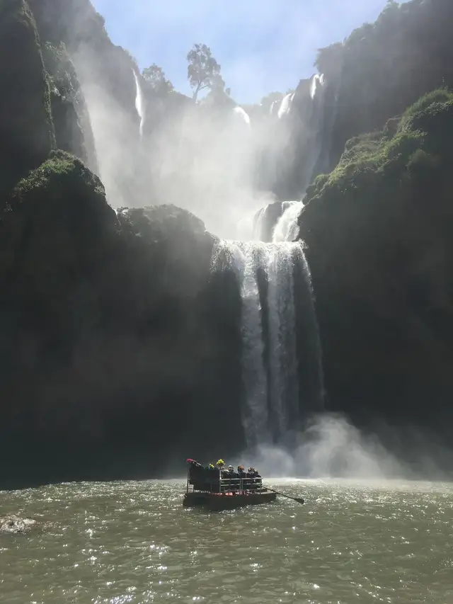 Cascades d'Ouzoudشلالات أوزودⵉⵎⵛⵛⴰⵚⵏ ⵏ ⵓⵥⵓⴹMorocco's highest multi-tiered waterfalls tumbling 110 meters through red cliffs and olive groves.Site · 1 to 2 days · 1,060 m
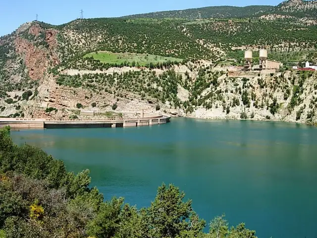 Bin El Ouidaneبين الويدانⴱⵉⵏ ⵍⵡⵉⴷⴰⵏDeep turquoise mountain lake framed by red limestone cliffs, pine forests, and water sports.Site · 2 to 3 days · 820 m
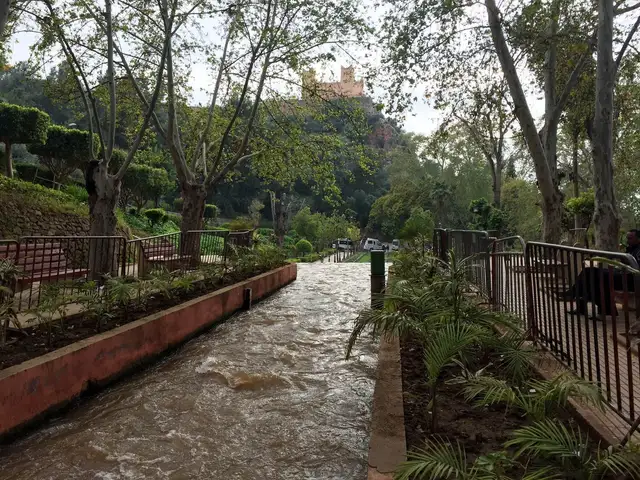 Béni Mellalبني ملالⴱⵏⵉ ⵎⵍⵍⴰⵍMiddle Atlas mountain foothill city famous for Ain Asserdoun spring, Kasbah Ras El Ain, and lush orchards.City · 1 to 2 days · 620 m